STORMWATER MANAGEMENT
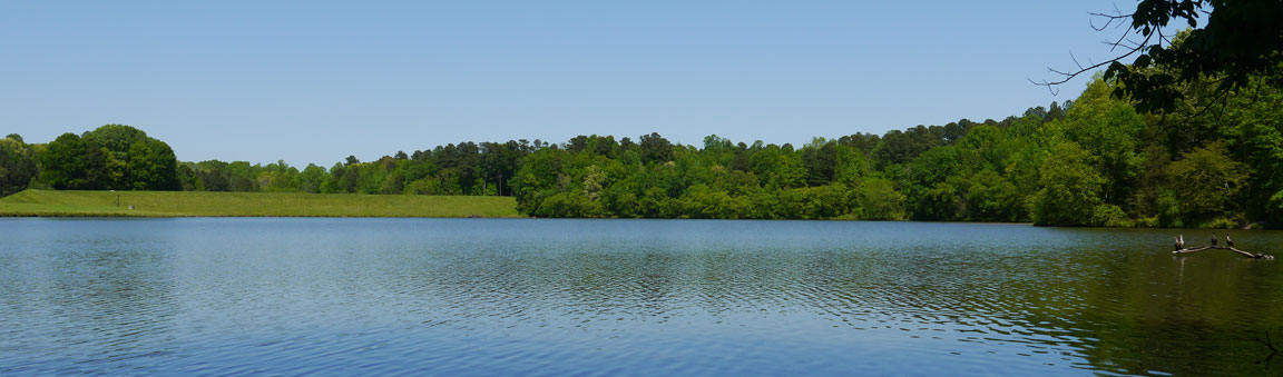
- The Reedy Creek Trenton Corridor lies within the Richland and Crabtree drainage basins. Richland Creek feeds the two Richland Creek stormwater control lakes constructed by Wake County in the 1980’s. The stormwater then flows into Crabtree Creek near William B. Umstead State Park. The lower Richland Lake is pictured above.
- The Richland basin collects stormwater from roughly Duraleigh Road in the north to Chapel Hill Road in the south and from Blue Ridge Road in the east to Trenton Road in the west. The area includes some of the State Fair Grounds, PNC Arena, Carter-Finley Stadium, the Inside Wade residential/commercial development and numerous other residential and commercial developments.
- Richland stormwater control lakes have flooded Reedy Creek Road during extreme weather events on at least three occasions since the 1990’s. The picture below, taken in November 2021, shows the amount of sediment that has come into the upper Richland Lake during the last year. This sediment prevents the lake from effectively managing stormwater.
- Richland Creek is a 5.25-mile long 2nd order tributary to Crabtree Creek in Raleigh that rises in a pond on the North Carolina State Fairgrounds. The creek then flows north under Wade Avenue and through Carl Alwin Schenck Memorial Forest to join Crabtree Creek near the south-eastern boundary of William B. Umstead State Park. The watershed is mainly developed with about 30% of it forested.
- Richland Creek drains 4.44 square miles of area and is underlaid by the Raleigh terrane geologic formation. The watershed receives an average of 46.3 inch/year of precipitation and has a wetness index of 407.29.

NC CONSTRUCTION SITE STORMWATER PERMITTING AND SITE STABILIZATION
In the Triangle area, where clay soils predominate, clay particles scoured by rainwater may result in brown-colored stormwater flowing directly off a new construction site or to an on-site sediment control basin.
Sediment-laden stormwater negatively impacts water quality downstream, with the corridor’s Richland Lake being a visible example. Water quality standards enforced by the NC Department of Environmental Quality (DEQ) reduce the impact of stormwater by regulating turbidity, the degree of brown color caused by sediment in the water. Turbidity is measured using a nephelometer, a device that shines a light beam through a water sample to detect the amount of light scattered by particles in the water. More scattered light indicates higher turbidity, which is reported in Nephelometric Turbidity Units (NTUs). DEQ regulations require that discharges to streams have a measurement of less than 50 NTUs (the water will appear misty). For comparison, drinking water should be five NTUs or less.
On all one-acre or larger construction sites, DEQ requires owner/operators to have a North Carolina Construction General Permit requiring that they provide specified stormwater protection actions throughout project construction. These actions include provision of large earthen basins and site stabilization. The basins are constructed for pre/post construction stormwater control and are typically engineered to result in compliant discharges. Without adequate vegetative or similar type stabilization, the stormwater treatment basins will be overloaded and unable to work as designed. Proper site stabilization minimizes both stormwater volume and sediment concentration flowing to the stormwater basins. The owner/operator is required to implement and maintain stabilization measures that minimize erosion from exposed portions of the site, even if that stormwater flows to the sediment basin.